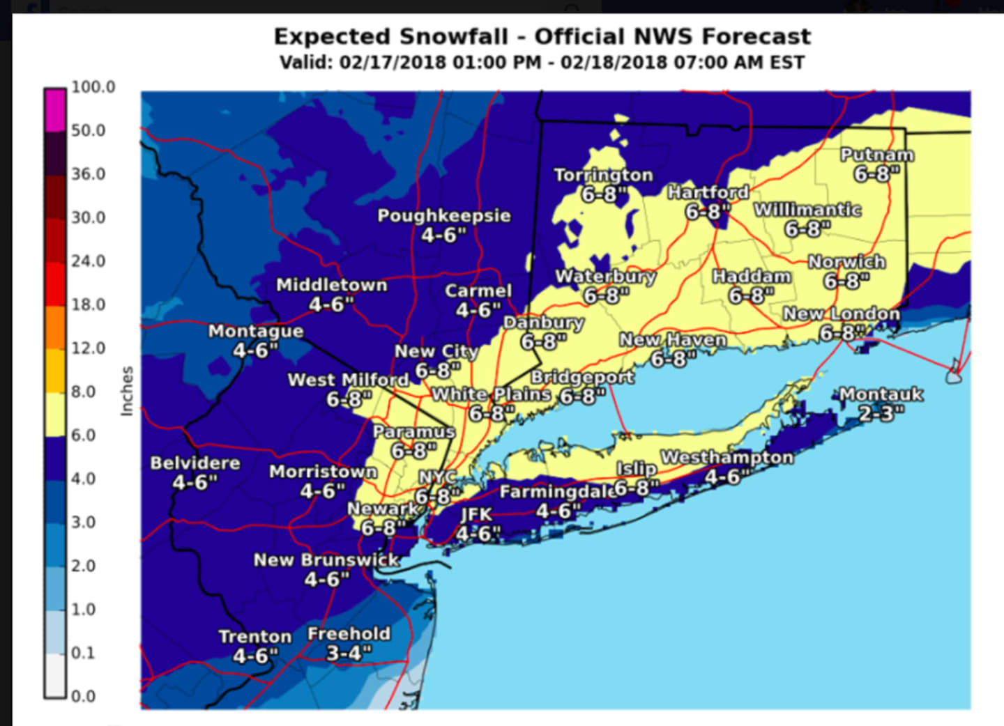

A fast-moving storm system has arrived in the area, with snowfall totals expected to be more than half a foot in some spots.
Snowfall accumulation of 4 to 8 inches is projected for most of the area before the system winds down early Sunday morning.
Snowfall rates of 1 to 2 inches per hour are expected late Saturday night into the very early hours of Sunday morning, with visibility of less than a quarter-mile at times. The reduced visibility and snow-covered roads will make for difficult travel conditions.
Isolated downed trees limbs and power outages could also occur.
Snowfall, which started early Saturday evening, will be heaviest between 10 p.m. Saturday to 2 a.m. Sunday.
Some of the snow should melt Sunday, which will bring a mix of clouds and sun and a high in the mid-40s.
Check back to Daily Voice for updates.
Click here to follow Daily Voice Northern Highlands and receive free news updates.